-
 1 x Barras de...59,90 €
No products
Pedidos inferiores a 69€: 6€
Pedidos superiores a 69€: Gratuito
*Aplicable en península y Baleares
Gastos de envío y entrega

No products
Advanced search of accessories for your motorcycle
 View larger

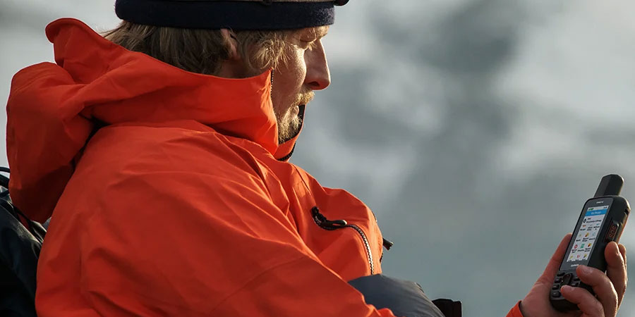
Navigation and communication all in one terminal. Garmin offers the GPS handheld device and satellite communication, the GPSMAPS 66i. You can access several global navigation systems, apart from GPS; you can plan and track your route with the Garmin Explore application; It includes ABC sensors with barometer and compass, among others; And the inReach is integrated.
More info
Accurate navigation and global communication come together in the rugged GPSMAP 66i: a handheld GPS device that also includes satellite communication, TopoActive mapping of Europe and Garmin inReach® technology.
You can access multiple global navigation satellite systems (GPS and GLONASS) for better tracking than just conventional GPS.
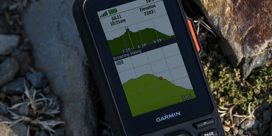
ABC sensors include an altimeter for altitude data, a barometer to monitor weather changes and a three-axis compass.
Allows direct download of realistic, high-resolution maps, with no annual subscription required. You can quickly and easily find routes, choose the best locations to stop, find nearby parking, create waypoints and much more.
✓ Display readable in any lighting. Use it in all weather conditions. GPSMAP 66i is designed for just that.
✓ With inReach, you can connect even in places where cell phones can't. Communicate with complete peace of mind. Always stay in touch and ready for all kinds of adventures.
✓S upport for multiple GNSS systems puts superior navigation at your fingertips.
✓ Get crisp, detailed maps without a subscription.
✓ Explore the terrain before you get into it with preloaded TopoActive maps of Europe. These maps will show you summits, parks, coastlines, rivers, lakes, geographic points and more.
enjoy more adventure time with up to 35 hours of battery life in tracking mode and up to 200 hours in low power mode.

Although it requires subscription to a satellite service, with it you can exchange text messages with your family or friends, post photos of your trip on social networks or communicate with other inReach devices that are in the same area.
In emergency situations, send an interactive SOS message directly to GEOS, Garmin's International Emergency Rescue Coordination Center (IERCC) with a professional global response and monitoring center available 24 hours a day (Satellite subscription required).
Share your location with colleagues you've ridden with or with those at home. They can track your mileage and progress, or request your GPS location, among other actions (Satellite subscription required).
Instead of relying on cellular coverage, now your messages, SOS alerts and tracking options are transmitted via the Iridium satellite network with global coverage (Satellite subscription required).
Using inReach connectivity you can get detailed weather updates on your GPSMAP 66i handheld or compatible device linked to the Garmin Explore™ app. Request the weather forecast for your current location, waypoints or destinations on your route.
When paired with your (compatible) smartphone, you can get real-time weather information as well as live weather radar so you always know what the conditions are around you.

This handheld device is designed to exacting military standards for both thermal performance and shock and water resistance (MIL-STD-810G) - it's even compatible with night vision goggles!
The GPSMAP 66 series has just about everything, allowing you to carry a lighter piece of equipment, as it has an integrated LED flashlight that can be used as a positioning beacon to pinpoint your exact location in case you need help.
Plan, choose and sync waypoints, routes and tracks with the Garmin Explore website and app. You can even view completed activities on the go.
With inReach technology, you can activate the low power mode and get up to 200 hours of autonomy. In default tracking mode, the battery lasts a maximum of 35 hours, and the device saves your location every 10 minutes.
Includes:
✓ TopoActive Maps: YES.
✓ inReach® technology: YES.
✓ Multiband technology: NO.
Data sheet
| Sku | 010-02088-02 |
| Function | Electronics |
| Family | GPS devices |
| compatible with smartphones | Yes |
| Waterproof | YES |
Sea el primero en hacer una consulta sobre este producto!